Air Traffic Management System
Air Traffic Management System
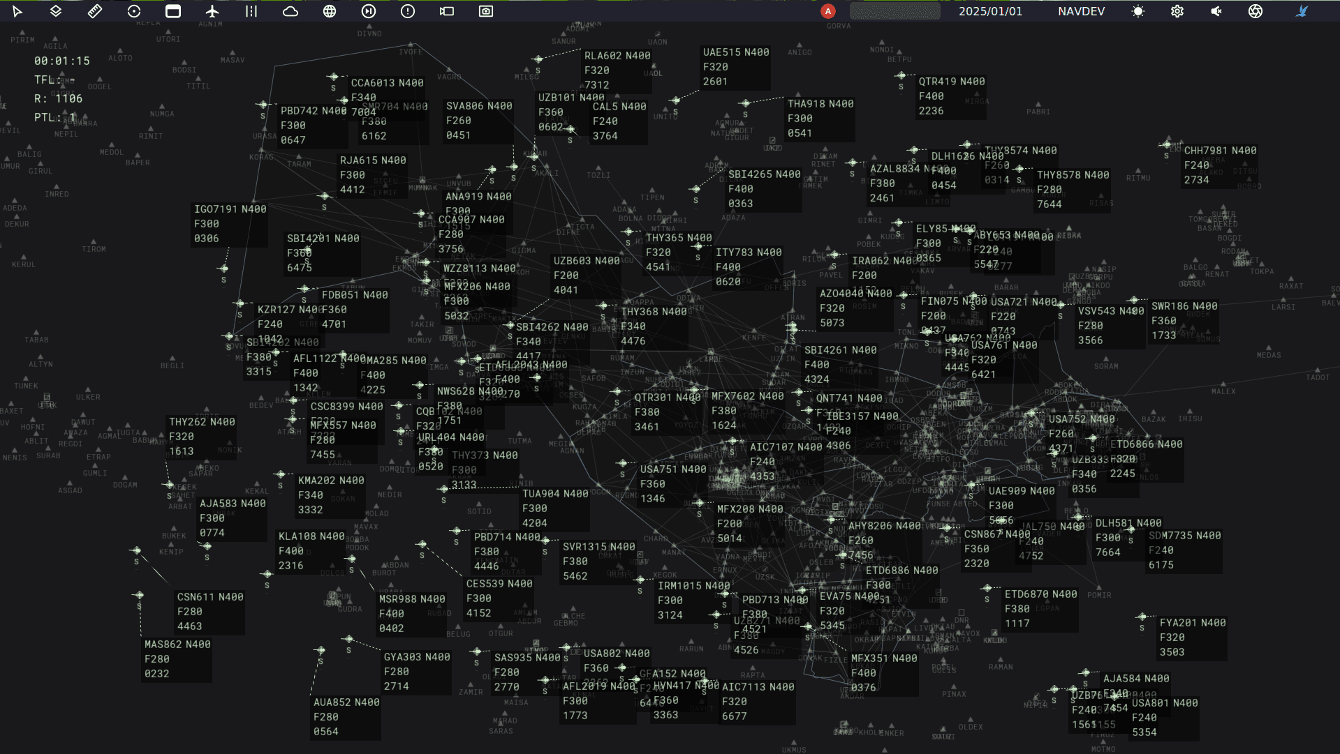
The Galerida stands as an advanced Air Traffic Management System, offering integration of Air Traffic Control, Airspace Management and Air Traffic Flow Management
Arrival Manager
The right arrival, in the right sequence, at the right time.
AMAN builds an optimized arrival sequence from estimated landing times, aircraft performance, runway occupancy and airspace constraints, then issues target arrival and sequence times to meter traffic and maintain predictable flow to the runway.
Continuous protection across air and ground.
The system supports real-time and strategic safety nets, including STCA, MSAW, APW, APM and MTCD, together with RIMCAS for runway and ground conflict detection, providing controllers with timely alerts across air and ground operations.
Connected communication.
The system integrates with aviation datalink networks to support services such as CPDLC and ADS-C, enabling reliable digital communication and data exchange between controllers and aircraft.
Departure Manager
The right aircraft at the holding point at the right minute.
DMAN builds a pre-departure sequence from off-block times, variable taxi times, runway occupancy and downstream flow constraints, then issues Target Start-Up Approval Times to the stand.
Flight information, ready when needed.
The system receives and transmits flight information through networks and interfaces such as AFTN, AMHS, OLDI and AIDC, giving users a single point of access to complete, up-to-date flight details.
Integrated Controller Working Position
Everything the controller needs, in one place.
The integrated working position brings together operational data such as AIP information, system tracks, E-Strips and meteorological data, alongside CNS, CCTV, airfield ground lighting and building control systems, providing controllers with a complete view of the operational environment from a single interface.
The right information for every route and procedure.
The system provides access to digital AIP data and other geodetic and aeronautical information, supporting accurate navigation, situational awareness and more efficient operations.
A complete picture of air and ground movement.
The system processes and fuses surveillance data from sources including PSR, SSR, Mode S, WAM, MLAT, ADS-B and SMR, providing continuous tracking and a unified operational picture for both air and ground operations.
Weather information, always in view.
The system integrates AWOS, METAR, weather radar, ATIS and other meteorological sources directly into the Controller Working Position, giving controllers immediate access to current conditions and forecast information.
